There are many benefits of using Google Earth. From the comfort of our homes, we can explore distant lands, navigate through bustling cities, and even take a virtual stroll down our own street. But one question that often arises is: how often does Google Earth update its street and satellite views?
The Basics

Google Earth, a product of Google’s innovative prowess, is constantly evolving. The frequency of its updates, however, is influenced by a combination of technological, logistical, and strategic factors.
Frequency of Updates
Google Earth doesn’t have a fixed schedule for updates. Instead, it updates images every one to three years, depending on various factors. Urban areas, given their dynamic nature, are updated more frequently than remote regions.
Why Are These Changes Common?
Several factors determine the update frequency. These include the availability of new imagery, the importance of the location, and the quality of the images. For instance, places of significant change or development might see more frequent updates.
Satellite View vs. Street View
While both satellite and street views are integral components of Google Earth, they have distinct update mechanisms and frequencies. Understanding the differences can provide clarity on what to expect in terms of freshness of imagery.
Satellite View Updates
Satellite images are sourced from third-party satellite companies. The frequency of updates depends on the satellite’s revisit time and the procurement of new images by Google. On average, satellite views are updated once every year.
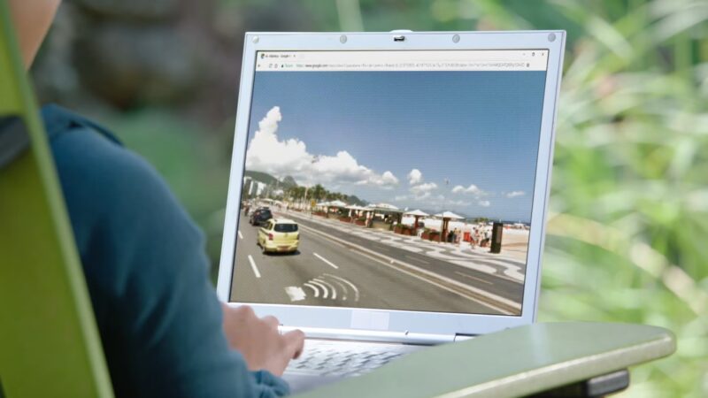
Street View Updates
Street View imagery comes from Google’s fleet of camera-equipped vehicles and sometimes, from individual contributors. Given the logistical challenges, Street View updates are less frequent, averaging once every two to three years for most locations.
Factors That Influence Update Frequency
The frequency of updates on Google Earth isn’t arbitrary. Several factors play a pivotal role in determining when a particular area gets a fresh set of images.
Technological Constraints
High-resolution imagery requires advanced satellite technology. The launch of newer satellites with better cameras can lead to more frequent and clearer updates.
Geopolitical Considerations
Some regions might have restrictions on high-resolution satellite imagery due to security concerns. Such areas might see less frequent updates or images with certain details obscured.
Logistical Challenges
For Street View, factors like weather conditions, road accessibility, and local regulations can influence the update schedule. Google must navigate these challenges to capture and update Street View imagery.
Benefits of Regular Updates
Regular updates on Google Earth are more than just about providing fresh imagery. They offer a range of benefits to users and serve various purposes.
Accurate Navigation
Updated images ensure that users have the latest information for navigation. This is especially crucial in rapidly developing urban areas where the landscape can change significantly in a short span.
Monitoring Environmental Changes
Regular updates can help in tracking environmental changes, such as deforestation, urbanization, or the effects of natural disasters. This can be invaluable for researchers and policymakers.
Enhanced User Experience
Fresh imagery ensures that users get the best experience, be it for casual exploration or professional use. Regular updates keep the platform relevant and engaging.
How Google Captures Data?
The magic of Google Earth doesn’t just happen. It’s a culmination of cutting-edge technology, meticulous planning, and a vast network of data sources. Let’s pull back the curtain and see how Google Earth captures its data.
Satellite Imagery
Google collaborates with several satellite companies to obtain high-resolution images. These satellites orbit the Earth, capturing vast swathes of land in each pass. Advanced cameras and sensors ensure that the images are of the highest quality.
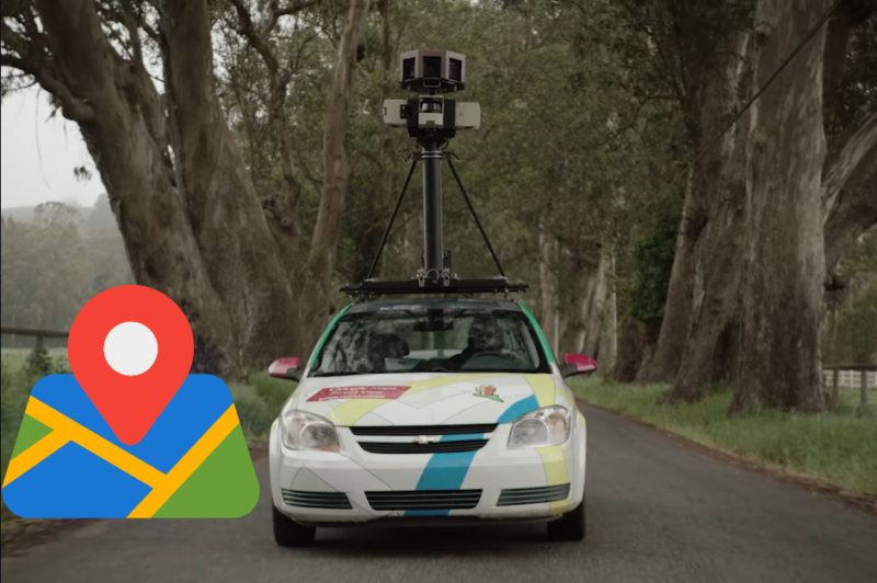
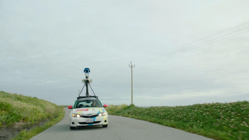
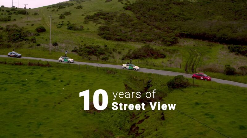
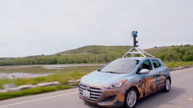
Street View Cameras
Google’s fleet of vehicles, equipped with 360-degree cameras, traverse the roads to capture Street View imagery. These cameras take pictures in every direction, which are then stitched together to create a seamless virtual environment.
Development Over Time
Google Earth has come a long way since its inception. Its journey from a standalone desktop application to a widely accessible web platform showcases its evolution in response to technological advancements and user needs.
Early Days
Launched in 2005, the initial versions of Google Earth were primarily focused on satellite imagery. The user interface and features were basic, but the ability to explore any corner of the world was revolutionary.
Introduction of Street View
2007 marked a significant milestone with the introduction of Street View. This feature allowed users to virtually walk down streets, enhancing the exploration experience. Over the years, Street View has expanded to cover vast areas, including remote locations and tourist attractions.
What’s Next for the Platform?

As technology continues to advance, so does the potential for Google Earth. The platform is poised to embrace newer technologies and offer even more immersive experiences in the future.
Integration with Augmented Reality (AR)
Imagine pointing your phone at a building and instantly getting information about it. With the rise of AR, such integrations could soon become a reality, making exploration more interactive and informative.
Real-time Updates
While real-time updates for the entire globe might be a distant dream, we could see more frequent updates for specific areas of interest. This would be particularly useful for monitoring real-time events or changes.
Enhanced 3D Modeling
As 3D technology improves, we can expect more detailed and accurate 3D models on Google Earth. This would allow users to virtually fly through cities, getting a closer look at buildings, landmarks, and natural formations.
Ethical Challenges
With great power comes great responsibility. The ability to view almost any location on Earth raises several ethical and privacy concerns. Google has been proactive in addressing these issues to ensure user trust and safety.
Blurring and Privacy
Recognizing the importance of privacy, Google automatically blurs faces and license plates in Street View. Users can also request additional blurring of their properties or sensitive locations.
Data Security
Google employs advanced encryption and security measures to protect the data and imagery on Google Earth. This ensures that the platform remains safe from potential cyber threats and unauthorized access.
Educational Potential
Beyond exploration and navigation, Google Earth has emerged as a valuable educational tool. Teachers and students worldwide are harnessing its capabilities to bring lessons to life.
Virtual Field Trips
With Google Earth, classrooms can embark on virtual field trips, exploring natural wonders, historical sites, and cultural landmarks without leaving their seats.
Interactive Learning
The platform offers interactive quizzes, challenges, and storytelling features. These tools make learning engaging and fun, allowing students to grasp complex topics with ease.
Impact on Businesses and Real Estate
Beyond personal exploration and education, Google Earth has had a profound impact on various industries, particularly in business and real estate. Its detailed imagery and frequent updates provide valuable insights that drive decision-making.
Real Estate Insights
Realtors and potential homebuyers use Google Earth to get a bird’s-eye view of properties, neighborhoods, and surrounding amenities. This visual perspective aids in property valuation and helps buyers make informed decisions.
Business Location Analysis
Entrepreneurs and businesses leverage Google Earth to analyze potential locations for their ventures. By studying traffic patterns, nearby competitors, and local demographics, they can choose optimal locations for their operations.
The Role in Disaster Management
In times of natural disasters and emergencies, timely and accurate information is crucial. Google Earth has emerged as a vital tool for disaster response teams and humanitarian organizations.
Mapping Disaster Zones
In the aftermath of earthquakes, floods, or wildfires, Google Earth provides updated imagery that helps in assessing the extent of damage. This aids in prioritizing rescue and relief efforts.
Resource Allocation
By visualizing affected areas, relief organizations can allocate resources more effectively, ensuring that aid reaches those in dire need promptly.
FAQs
Can users request specific areas to be updated on Google Earth?
Yes, while Google doesn’t guarantee that user-requested areas will be updated immediately, there is a community where users can express interest in specific regions. Google takes these requests into consideration, especially if there’s significant demand.
How does Google Earth handle disputed territories or borders?
Google Earth aims to provide an unbiased view of the world. For disputed territories or borders, they often display dotted lines or use internationally recognized boundaries. They may also provide multiple labels or annotations to reflect different perspectives.
Are there areas that Google Earth intentionally doesn’t update or show?
Yes, for security and privacy reasons, certain locations like military bases, nuclear facilities, or other sensitive areas might be blurred, outdated, or not shown in high resolution.
How does Google Earth ensure the accuracy of its imagery?
Google Earth sources its imagery from reputable satellite companies and uses advanced algorithms to stitch together and align images. They also cross-reference with other data sources and rely on user feedback to correct any discrepancies.
How does Google Earth’s update frequency compare to other similar platforms?
Google Earth is among the leaders when it comes to update frequency, especially for major urban areas. However, the exact comparison varies based on the region and the type of imagery (satellite vs. street view). Other platforms might have more recent images for specific areas, but Google Earth’s comprehensive coverage is unparalleled.
Last Words
The world is ever-changing, and so is the technology that allows us to explore it. Google Earth stands as a testament to human curiosity and our desire to understand our planet better.
With its regular updates, advanced data capturing techniques, and a vision for the future, Google Earth continues to be a window to the world for many.
It is a great thing that we can always choose between different platforms due to expanded flexibility of websites that are offering all kinds of services. We recently reviewed Paramount Network and how it compares to Paramount Plus. You can read more about it on our website.